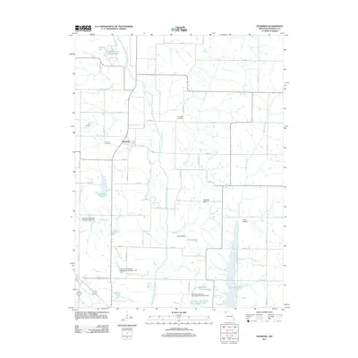
2011 Map of Pickering
USGS Topo · Published 2011About this map
One Hundred and Two River snakes through the center of this Nodaway County landscape, anchoring a complex system of drainage and water management. The settlement of Pickering sits at the intersection of 190th St and Ivory Rd, surrounded by rural landmarks like the Coleman Cemetery and Gray Cemetery. The terrain is defined by distinct local formations such as Pinhook Hills, Jack Hollow, and Long Hollow, which break the agricultural grid. Extensive watershed infrastructure is evident through features like the 102 River Tributaries Watershed Number 12 Dam, reflecting modern efforts to control the flow into Mozingo Lake and Nodaway Lake. Genealogy researchers will find significant value in the distribution of family-named water bodies and burial grounds, including Whiteoak Cemetery to the east and Parman Lake in the southwest corner near Isadore Ave.
Find a feature on this map
52 named features on this map. Tap any name to fly to it.
Don’t see what you’re looking for? This feature index may not catch every label — zoom into the map to look around manually.
Map Details
Editions of this 2011 Pickering Map
This is the sole edition of this map. No revisions or reprints were ever made.
Other maps of this area

1940 · Bedford
USGS Topo · 1:62,500

1940 · New Market
USGS Topo · 1:62,500

1940 · Parnell
USGS Topo · 1:62,500

1943 · Bedford
USGS Topo · 1:62,500

1943 · Parnell
USGS Topo · 1:62,500

1943 · Maryville
USGS Topo · 1:62,500

1943 · New Market
USGS Topo · 1:62,500

1955 · Nebraska City
USGS Topo · 1:250,000

1957 · Nebraska City
USGS Topo · 1:250,000

1958 · Nebraska City
USGS Topo · 1:250,000