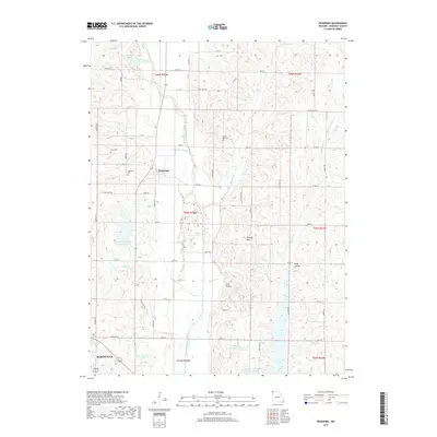
2017 Map of Pickering
USGS Topo · Published 2017About this map
The town of Pickering and the northern edge of Maryville anchor this Missouri landscape, where the meandering One Hundred and Two River and its numerous tributaries dictate the local topography. This 2017 survey shows a region defined by agricultural land and significant water management, evidenced by the many reservoirs such as Nodaway County Community Lake, Robbins Lake, and the 102 River Tributaries Watershed 9 Lake. For genealogists and local historians, the map accurately preserves the locations of several burial grounds, including White Oak Cem, Gray Cem, and Coleman Cem. The terrain is marked by distinctive features like the Pinhook Hills, Jack Hollow, and Long Hollow, which create a varied elevation profile across the Nodaway County countryside. The intricate network of local routes, including State Hwy B and State Hwy NN, connects these rural landmarks to the larger community hubs.
Find a feature on this map
44 named features on this map. Tap any name to fly to it.
Don’t see what you’re looking for? This feature index may not catch every label — zoom into the map to look around manually.
Map Details
Editions of this 2017 Pickering Map
This is the sole edition of this map. No revisions or reprints were ever made.
Other maps of this area

1940 · Bedford
USGS Topo · 1:62,500

1940 · New Market
USGS Topo · 1:62,500

1940 · Parnell
USGS Topo · 1:62,500

1943 · Bedford
USGS Topo · 1:62,500

1943 · Parnell
USGS Topo · 1:62,500

1943 · Maryville
USGS Topo · 1:62,500

1943 · New Market
USGS Topo · 1:62,500

1955 · Nebraska City
USGS Topo · 1:250,000

1957 · Nebraska City
USGS Topo · 1:250,000

1958 · Nebraska City
USGS Topo · 1:250,000