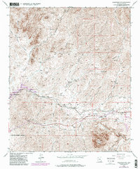
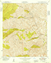
1948 Map of Picketpost Mtn
USGS Topo · Published 1982About this map
Picketpost Mountain dominates the southern landscape of this area, overlooking a complex network of canyons and mining-era infrastructure within the Tonto National Forest. The eastern edge of the survey reveals the town of Superior and the nearby Old Pinal Townsite, reflecting the deep copper mining history of the region. Transportation and communication lines are clearly marked, including the Magma Arizona Railroad and a long-distance telephone line following the desert floor.
Find a feature on this map
41 named features on this map. Tap any name to fly to it.
Don’t see what you’re looking for? This feature index may not catch every label — zoom into the map to look around manually.
Map Details
Editions of this 1948 Picketpost Mtn Map
4 editions found
Other maps of this area

1900 · Florence
USGS Topo · 1:125,000

1902 · Florence
USGS Topo · 1:125,000

1948 · Superior
USGS Topo · 1:62,500

1948 · Superior
USGS Topo · 1:24,000

1948 · Iron Mountain
USGS Topo · 1:24,000
1948 · Haunted Canyon
USGS Topo · 1:24,000

1948 · Picketpost Mtn
USGS Topo · 1:24,000

1949 · Superior
USGS Topo · 1:24,000

1949 · Iron Mountain
USGS Topo · 1:24,000
1949 · Haunted Canyon
USGS Topo · 1:24,000