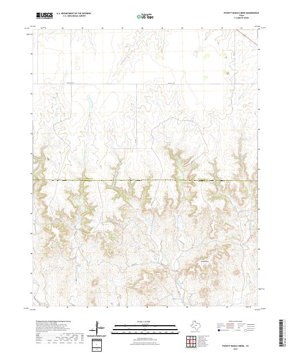
2022 Map of Pickett Ranch Creek
USGS Topo · Published 2022About this map
Tandy Mesa rises as a prominent landmark in this section of the Texas Panhandle, anchoring a landscape defined by the intricate drainage systems of the Canadian River watershed. The boundary between Ochiltree and Roberts Counties bisects the terrain, illustrating the rural division of these High Plains ranch lands. A network of local corridors like Hanks Rd and Tandy Rd provides access through the dissected breaks, where waterways such as Pickett Ranch Creek and Northwest Fork Point Creek have carved deep relief into the plateau. The cartography reveals a sparsely populated region where infrastructure is primarily dedicated to ranching and local transit, with Ranch Rd 281 serving as the primary east-west artery across the northern reaches of the quadrangle.
Find a feature on this map
16 named features on this map. Tap any name to fly to it.
Don’t see what you’re looking for? This feature index may not catch every label — zoom into the map to look around manually.
Map Details
Editions of this 2022 Pickett Ranch Creek Map
This is the sole edition of this map. No revisions or reprints were ever made.
Other maps of this area

1954 · Perryton
USGS Topo · 1:250,000

1954 · Amarillo
USGS Topo · 1:250,000

1958 · Perryton
USGS Topo · 1:250,000

1958 · Amarillo
USGS Topo · 1:250,000

1971 · Dry Creek NE
USGS Topo · 1:24,000

1972 · Horse Creek North
USGS Topo · 1:24,000

1972 · East Dry Creek
USGS Topo · 1:24,000

1973 · Sourdough Creek NE
USGS Topo · 1:24,000

1973 · Pickett Ranch Creek
USGS Topo · 1:24,000

1973 · Lake Fryer
USGS Topo · 1:24,000