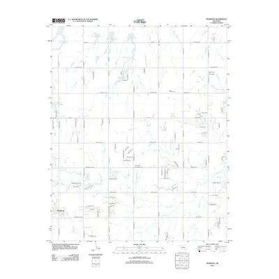
2012 Map of Piedmont
USGS Topo · Published 2012About this map
The town of Piedmont sits at the heart of this landscape, showing a modern grid of residential growth interspersed with the persistent agricultural and industrial patterns of Central Oklahoma. Water management defines the northern terrain, where a series of flood control structures including Cottonwood Cr Site 15 Reservoir, Cottonwood Cr Site 18 Reservoir, and Cottonwood Cr Site 19 Reservoir dot the drainage basins.
Find a feature on this map
105 named features on this map. Tap any name to fly to it.
Don’t see what you’re looking for? This feature index may not catch every label — zoom into the map to look around manually.
Map Details
Editions of this 2012 Piedmont Map
This is the sole edition of this map. No revisions or reprints were ever made.
Other maps of this area

1892 · Kingfisher
USGS Topo · 1:125,000

1895 · Kingfisher
USGS Topo · 1:125,000

1951 · Britton
USGS Topo · 1:24,000

1954 · Oklahoma City
USGS Topo · 1:250,000

1957 · Oklahoma City
USGS Topo · 1:250,000

1963 · Oklahoma City
USGS Topo · 1:250,000
1966 · Bethany
USGS Topo · 1:24,000
1966 · Bethany NE
USGS Topo · 1:24,000

1966 · Piedmont
USGS Topo · 1:24,000
1970 · Navina
USGS Topo · 1:24,000
Featured Places
- Oklahoma City, OK
- Piedmont, OK
- Sportsman's Lake Estates I, OK
- Sportsman's Lake Estates II, OK
- Oklahoma County, OK