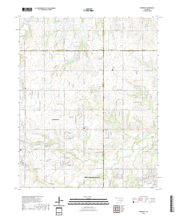
2022 Map of Piedmont
USGS Topo · Published 2022About this map
The city of Piedmont serves as a central hub in this modern survey, where the convergence of four Oklahoma counties—Canadian, Kingfisher, Logan, and Oklahoma—shapes the local geography. The landscape is defined by a dense network of suburban expansion and section-line roads, such as Mustang Rd NE and N Council Rd, extending from the northern edge of Oklahoma City. Despite this growth, significant local landmarks like Saint Patrick Cem and Kansas Cem provide essential anchor points for genealogists tracing family roots in the area. The terrain transitions from the residential blocks of Piedmont to the more open country near Smokey Bend Ridge, marked by numerous water management features like Cypert 209 Reservoir and Cottonwood Cr Site 18 Reservoir. The map also details local aviation at Caribou Airport, situated along the eastern drainage of Deer Cr.
Find a feature on this map
125 named features on this map. Tap any name to fly to it.
Don’t see what you’re looking for? This feature index may not catch every label — zoom into the map to look around manually.
Map Details
Editions of this 2022 Piedmont Map
This is the sole edition of this map. No revisions or reprints were ever made.
Other maps of this area

1892 · Kingfisher
USGS Topo · 1:125,000

1895 · Kingfisher
USGS Topo · 1:125,000

1951 · Britton
USGS Topo · 1:24,000

1954 · Oklahoma City
USGS Topo · 1:250,000

1957 · Oklahoma City
USGS Topo · 1:250,000

1963 · Oklahoma City
USGS Topo · 1:250,000
1966 · Bethany
USGS Topo · 1:24,000
1966 · Bethany NE
USGS Topo · 1:24,000

1966 · Piedmont
USGS Topo · 1:24,000
1970 · Navina
USGS Topo · 1:24,000
Featured Places
- Oklahoma City, OK
- Piedmont, OK
- Sportsman's Lake Estates I, OK
- Sportsman's Lake Estates II, OK
- Oklahoma County, OK