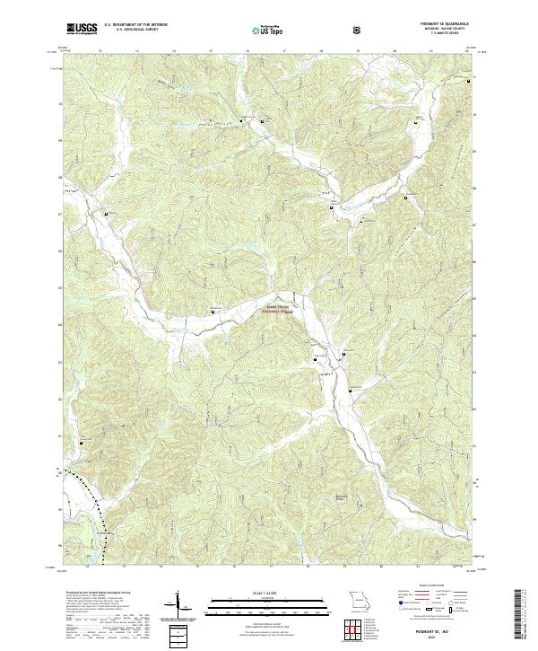
2021 Map of Piedmont SE
USGS Topo · Published 2021About this map
Granite Bend serves as a lone named settlement in this pocket of Wayne County, situated at the southwestern edge of the survey area. The landscape is defined by the sharp relief of the Ozarks, where numerous hollows and ridges dictate the drainage patterns of Otter Creek and the Black River. Within the Mark Twain National Forest, the terrain is punctuated by significant family-named landmarks like Meador Valley, Handy Hollow, and Blackwell Ridge. This 2021 mapping effort illustrates a region where local heritage is preserved primarily through its numerous rural burial grounds, including Meadors Cem, Liberty Hill Cem, and the Eads Creek Cem. The concentration of cemeteries relative to the lack of contemporary town centers highlights the long-standing family ties to these specific valleys and creek branches.
Find a feature on this map
42 named features on this map. Tap any name to fly to it.
Don’t see what you’re looking for? This feature index may not catch every label — zoom into the map to look around manually.
Map Details
Editions of this 2021 Piedmont SE Map
This is the sole edition of this map. No revisions or reprints were ever made.
Other maps of this area

1932 · Piedmont
USGS Topo · 1:62,500

1934 · Greenville
USGS Topo · 1:62,500

1934 · Williamsville
USGS Topo · 1:48,000

1935 · Poplar Bluff
USGS Topo · 1:62,500

1935 · Piedmont
USGS Topo · 1:62,500

1939 · Greenville
USGS Topo · 1:62,500

1939 · Poplar Bluff
USGS Topo · 1:62,500

1940 · Williamsville
USGS Topo · 1:62,500

1949 · Rolla
USGS Topo · 1:250,000

1949 · Poplar Bluff
USGS Topo · 1:62,500