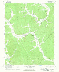
1967 Map of Piedmont SE
USGS Topo · Published 1969About this map
The Black River valley and its surrounding timberlands are documented in this late 1960s survey of Wayne County. The landscape is defined by the Clark National Forest and several distinct land divisions including Mill Spring and St Francois. Industrial activity is evident through numerous mines and quarries scattered throughout the hills, particularly near the Missouri Pacific railroad line that tracks alongside the river.
Find a feature on this map
49 named features on this map. Tap any name to fly to it.
Don’t see what you’re looking for? This feature index may not catch every label — zoom into the map to look around manually.
Map Details
Editions of this 1967 Piedmont SE Map
This is the sole edition of this map. No revisions or reprints were ever made.
Other maps of this area

1932 · Piedmont
USGS Topo · 1:62,500

1934 · Greenville
USGS Topo · 1:62,500

1934 · Williamsville
USGS Topo · 1:48,000

1935 · Poplar Bluff
USGS Topo · 1:62,500

1935 · Piedmont
USGS Topo · 1:62,500

1939 · Greenville
USGS Topo · 1:62,500

1939 · Poplar Bluff
USGS Topo · 1:62,500

1940 · Williamsville
USGS Topo · 1:62,500

1949 · Rolla
USGS Topo · 1:250,000

1949 · Poplar Bluff
USGS Topo · 1:62,500