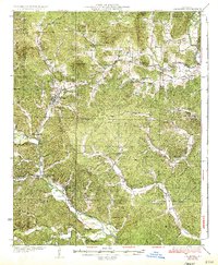
1935 Map of Piedmont
USGS Topo · Published 1935About this map
The Missouri Pacific RR defines the corridor of commerce and travel through the western half of this Wayne County landscape, connecting the hub of Piedmont with southern settlements like Mill Spring and Barlow. The topography is dominated by the complex ridges of the St. Francois Mountains, featuring landmarks such as Clark Mtn and Gads Hill. In the northeast, the St. Francis River cuts through the terrain near Sam A Baker State Park, while the Black River snakes through the southwest.
Find a feature on this map
84 named features on this map. Tap any name to fly to it.
Don’t see what you’re looking for? This feature index may not catch every label — zoom into the map to look around manually.
Map Details
Editions of this 1935 Piedmont Map
2 editions found
Other maps of this area

1926 · Des Arc
USGS Topo · 1:62,500

1929 · Des Arc
USGS Topo · 1:62,500

1930 · Coldwater
USGS Topo · 1:62,500

1932 · Piedmont
USGS Topo · 1:62,500

1934 · Greenville
USGS Topo · 1:62,500

1934 · Williamsville
USGS Topo · 1:48,000

1935 · Poplar Bluff
USGS Topo · 1:62,500

1935 · Piedmont
USGS Topo · 1:62,500

1939 · Greenville
USGS Topo · 1:62,500

1939 · Poplar Bluff
USGS Topo · 1:62,500