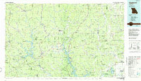
1986 Map of Piedmont
USGS Topo · Published 1986About this map
Piedmont and the surrounding Ozark foothills appear in this mid-1980s survey, showing a landscape defined by state and national forests and major water management projects. The Black River feeds the prominent Clearwater Lake, while the St Francis River flows toward Lake Wappapello in the southeast, creating a complex of riparian and recreation zones. The Missouri Pacific railroad cuts a north-south path through the center of the sheet, connecting towns like Annapolis, Leeper, and Mill Spring.
Find a feature on this map
184 named features on this map. Tap any name to fly to it.
Don’t see what you’re looking for? This feature index may not catch every label — zoom into the map to look around manually.
Map Details
Editions of this 1986 Piedmont Map
2 editions found
Other maps of this area

1910 · Higdon
USGS Topo · 1:62,500

1923 · Perryville
USGS Topo · 1:62,500

1924 · Perryville
USGS Topo · 1:62,500

1924 · Edgehill
USGS Topo · 1:62,500

1926 · Edgehill
USGS Topo · 1:62,500

1926 · Des Arc
USGS Topo · 1:62,500

1928 · Cardareva
USGS Topo · 1:62,500

1929 · Des Arc
USGS Topo · 1:62,500

1930 · Coldwater
USGS Topo · 1:62,500

1932 · Piedmont
USGS Topo · 1:62,500