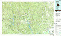
1986 Map of Piedmont
USGS Topo · Published 1987About this map
Sam A Baker State Park and the rugged topography of the St. Francois Mountains define this mid-1980s survey of the Missouri Ozarks. The landscape is a complex network of conservation areas, including the Mark Twain National Forest and several state forests like Clearwater State Forest, reflecting a region deeply tied to its natural resources and public lands. Major water bodies such as Clearwater Lake and Wappapello Lake disrupt the heavily wooded terrain, while the Black River and its forks provide the primary drainage.
Find a feature on this map
146 named features on this map. Tap any name to fly to it.
Don’t see what you’re looking for? This feature index may not catch every label — zoom into the map to look around manually.
Map Details
Editions of this 1986 Piedmont Map
2 editions found
Other maps of this area

1910 · Higdon
USGS Topo · 1:62,500

1923 · Perryville
USGS Topo · 1:62,500

1924 · Perryville
USGS Topo · 1:62,500

1924 · Edgehill
USGS Topo · 1:62,500

1926 · Edgehill
USGS Topo · 1:62,500

1926 · Des Arc
USGS Topo · 1:62,500

1928 · Cardareva
USGS Topo · 1:62,500

1929 · Des Arc
USGS Topo · 1:62,500

1930 · Coldwater
USGS Topo · 1:62,500

1932 · Piedmont
USGS Topo · 1:62,500