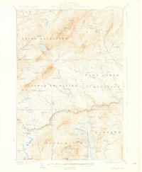
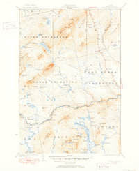
1927 Map of Pierce Pond
USGS Topo · Published 1927About this map
The Dead River carves a central path through this Maine wilderness, defining the transition between the townships of Upper Enchanted and Lower Enchanted. In the mid-1920s, this landscape was a hub for logging and early outdoor recreation, evidenced by isolated outposts like Depot Camp and Salmon Stream Farm. The hydrology of the region is punctuated by the Dead River Dam and the P D Dam, which managed water flow for timber drives or early power needs.
Find a feature on this map
83 named features on this map. Tap any name to fly to it.
Don’t see what you’re looking for? This feature index may not catch every label — zoom into the map to look around manually.
Map Details
Editions of this 1927 Pierce Pond Map
6 editions found

Other maps of this area

1903 · Bingham
USGS Topo · 1:62,500

1905 · Bingham
USGS Topo · 1:62,500

1905 · The Forks
USGS Topo · 1:62,500

1907 · The Forks
USGS Topo · 1:62,500

1921 · Brassua Lake
USGS Topo · 1:62,500

1922 · Long Pond
USGS Topo · 1:62,500

1923 · Brassua Lake
USGS Topo · 1:62,500

1923 · Attean
USGS Topo · 1:62,500

1924 · Long Pond
USGS Topo · 1:62,500

1925 · Pierce Pond
USGS Topo · 1:48,000
Featured Places
- West Forks, ME
- Hayden Landing, Pierce Pond Township
- Upper Enchanted Township, ME
- Johnson Mountain Township, ME
- Bowtown Township, ME