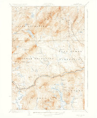
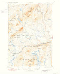
1927 Map of Pierce Pond
USGS Topo · Published 1935About this map
West Forks Plantation and the neighboring unorganized townships of Upper Enchanted, Lower Enchanted, and Bowtown define this 1920s landscape of the Maine North Woods. The map captures a transition period for the Dead River, documented shortly before the construction of major hydroelectric dams downstream would forever alter the waterway. Evidence of a remote timber-and-tourism economy is visible through dispersed outposts like Grace Pond Camp, Pierce Pond Camps, and the Comber Inn situated along State Highway No 201.
Find a feature on this map
81 named features on this map. Tap any name to fly to it.
Don’t see what you’re looking for? This feature index may not catch every label — zoom into the map to look around manually.
Map Details
Editions of this 1927 Pierce Pond Map
6 editions found

Other maps of this area

1903 · Bingham
USGS Topo · 1:62,500

1905 · Bingham
USGS Topo · 1:62,500

1905 · The Forks
USGS Topo · 1:62,500

1907 · The Forks
USGS Topo · 1:62,500

1921 · Brassua Lake
USGS Topo · 1:62,500

1922 · Long Pond
USGS Topo · 1:62,500

1923 · Brassua Lake
USGS Topo · 1:62,500

1923 · Attean
USGS Topo · 1:62,500

1924 · Long Pond
USGS Topo · 1:62,500

1925 · Pierce Pond
USGS Topo · 1:48,000
Featured Places
- West Forks, ME
- Hayden Landing, Pierce Pond Township
- Upper Enchanted Township, ME
- Johnson Mountain Township, ME
- Bowtown Township, ME