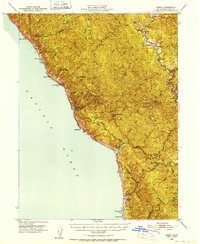
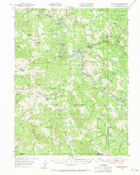
1950 Map of Piercy
USGS Topo · Published 1952About this map
The South Fork Eel River winds through the eastern portion of this Mendocino County landscape, where the settlement of Piercy and the lumber-associated Andersonia stand near the Richardson Grove State Park boundary. This mid-century survey documents a transition in land use, noting established locations like Metcalf Ranch alongside the former positions of Moody (Site) and Kenny (Site). To the west, the coastline is defined by sharp elevation changes at Jackass Ridge and Timber Ridge, leading to the Pacific at Bear Harbor and Needle Rock. Interior settlement patterns are concentrated along watercourses such as Usal Creek and Hollow Tree Creek, where Hollow Tree (Hales Grove) serves as a primary inland marker. The map captures the rugged coastal topography before modern development, identifying remote points like Mistake Point and the intersection at Four Corners.
Find a feature on this map
42 named features on this map. Tap any name to fly to it.
Don’t see what you’re looking for? This feature index may not catch every label — zoom into the map to look around manually.
Map Details
Editions of this 1950 Piercy Map
5 editions found

Other maps of this area

1920 · Pt. Delagda
USGS Topo · 1:62,500

1920 · Cummings
USGS Topo · 1:62,500

1920 · Harris
USGS Topo · 1:62,500

1921 · Westport
USGS Topo · 1:62,500

1921 · Briceland
USGS Topo · 1:62,500

1921 · Branscomb
USGS Topo · 1:62,500

1949 · Eureka
USGS Topo · 1:250,000
1949 · Alderpoint
USGS Topo · 1:62,500
1949 · Point Delgada
USGS Topo · 1:62,500
1949 · Garberville
USGS Topo · 1:62,500