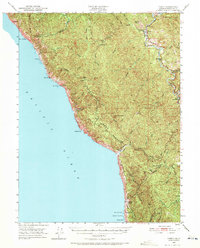
1950 Map of Piercy
USGS Topo · Published 1971About this map
Piercy and Andersonia serve as the primary inland hubs of this 1950 coastal survey, situated where the Redwood Highway traces the South Fork Eel River. The map illustrates a transitional landscape between the inland timber regions and the rocky Pacific coastline. Significant cultural data is preserved through the identification of early settlements and ranching outposts, including Moody (Site) and Kenny (Site), as well as family-named properties like Metcalf Ranch and De Vilbiss Ranch. The topographic detail reveals the isolation of the coast at Bear Harbor and Mistake Point, separated from the interior by the high elevations of Timber Ridge and Jackass Ridge. For historians, the inclusion of remote locations like Dugans Opening and the logging-related settlement of Wheeler provides a window into the mid-century industrial and agricultural life of Mendocino County before more modern development reshaped the region.
Find a feature on this map
43 named features on this map. Tap any name to fly to it.
Don’t see what you’re looking for? This feature index may not catch every label — zoom into the map to look around manually.
Map Details
Editions of this 1950 Piercy Map
5 editions found

Other maps of this area

1920 · Pt. Delagda
USGS Topo · 1:62,500

1920 · Cummings
USGS Topo · 1:62,500

1920 · Harris
USGS Topo · 1:62,500

1921 · Westport
USGS Topo · 1:62,500

1921 · Briceland
USGS Topo · 1:62,500

1921 · Branscomb
USGS Topo · 1:62,500

1949 · Eureka
USGS Topo · 1:250,000

1949 · Alderpoint
USGS Topo · 1:62,500

1949 · Point Delgada
USGS Topo · 1:62,500

1949 · Garberville
USGS Topo · 1:62,500