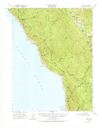
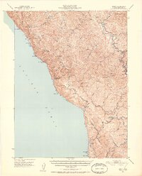
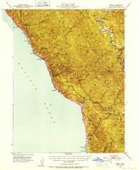
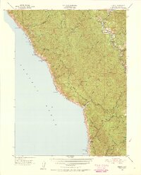
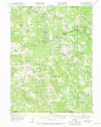
1950 Map of Piercy
USGS Topo · Published 1971About this map
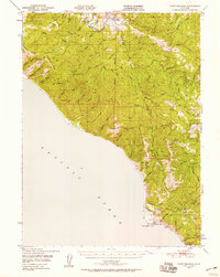
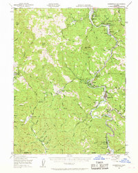
South Fork Eel River defines the eastern corridor of this 1950s study, where the Redwood Highway serves as the primary artery through the Mendocino wilderness. This era shows the logging and ranching foundations of the region, anchored by settlements like Piercy and Andersonia. Along the coastline, the landscape is marked by steep maritime topography including Jackass Ridge and Timber Ridge, where isolation is evident at former landing sites like Needle Rock and Bear Harbor. A Sawmill near the Mattole River headwaters and a Tree House landmark near the riverbank reflect the diverse local economy of the mid-century. Several locations are already identified as historical remnants, such as Moody (Site) and Kenny (Site), providing a clear look at the shifting footprint of human activity before modern development altered these remote drainages.
Find a feature on this map
80 named features on this map. Tap any name to fly to it.
Don’t see what you’re looking for? This feature index may not catch every label — zoom into the map to look around manually.
Map Details
Editions of this 1950 Piercy Map
5 editions found

Other maps of this area

1920 · Pt. Delagda
USGS Topo · 1:62,500

1920 · Cummings
USGS Topo · 1:62,500

1920 · Harris
USGS Topo · 1:62,500

1921 · Westport
USGS Topo · 1:62,500

1921 · Briceland
USGS Topo · 1:62,500

1921 · Branscomb
USGS Topo · 1:62,500

1949 · Eureka
USGS Topo · 1:250,000
1949 · Alderpoint
USGS Topo · 1:62,500
1949 · Point Delgada
USGS Topo · 1:62,500
1949 · Garberville
USGS Topo · 1:62,500