
1969 Map of Pierson
USGS Topo · Published 1971About this map
Pierson serves as the primary settlement center within this 1969 topographic study, situated where the Illinois Central Railroad Grade cuts through the western Iowa landscape. The map reveals a highly organized rural infrastructure, with townships like Garfield, Grand Meadow, and Union defined by a network of section roads and small-scale community landmarks. Local history is anchored by several rural institutions, including the Grand Meadow Sch and Meadow Star Ch, alongside multiple burial grounds such as Greenwood Cem and Good Hope Cem. The terrain is shaped by the drainage patterns of Buffalo Creek and Pierson Creek, eventually leading to the wider valley of the Little Sioux River in the southeast corner. This area’s economic character is visible through features like a local Golf Course and a Gravel Pit near the river, reflecting a mix of recreation and resource extraction.
Find a feature on this map
22 named features on this map. Tap any name to fly to it.
Don’t see what you’re looking for? This feature index may not catch every label — zoom into the map to look around manually.
Map Details
Editions of this 1969 Pierson Map
This is the sole edition of this map. No revisions or reprints were ever made.
Other maps of this area

1954 · Fort Dodge
USGS Topo · 1:250,000

1957 · Fort Dodge
USGS Topo · 1:250,000

1958 · Fort Dodge
USGS Topo · 1:250,000

1969 · Correctionville NW
USGS Topo · 1:24,000

1969 · Fielding
USGS Topo · 1:24,000

1969 · Correctionville
USGS Topo · 1:24,000
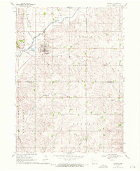
1969 · Kingsley
USGS Topo · 1:24,000

1969 · Cushing
USGS Topo · 1:24,000
1969 · Kingsley NW
USGS Topo · 1:24,000
1969 · Washta
USGS Topo · 1:24,000