
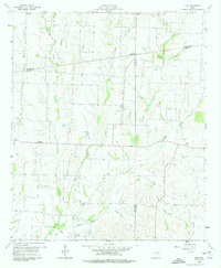
1960 Map of Pike
USGS Topo · Published 1962About this map
Pike and the surrounding rural communities of Nobility, Delby, Frognot, and Arnold represent the classic agricultural landscape of northeast Texas at the dawn of the 1960s. The area is defined by the convergence of three counties—Collin, Fannin, and Hunt—where the headwaters of numerous creeks like Indian Creek, Arnold Creek, and Pot Rack Creek carve through the terrain. This survey was produced in collaboration with the North Texas Municipal Water District and the Board of Water Engineers, highlighting the region's importance for water resource management.
Find a feature on this map
28 named features on this map. Tap any name to fly to it.
Don’t see what you’re looking for? This feature index may not catch every label — zoom into the map to look around manually.
Map Details
Editions of this 1960 Pike Map
2 editions found
Other maps of this area

1930 · Farmersville
USGS Topo · 1:62,500

1954 · Sherman
USGS Topo · 1:250,000

1958 · Sherman
USGS Topo · 1:250,000

1960 · Blue Ridge
USGS Topo · 1:24,000

1960 · Culleoka
USGS Topo · 1:24,000

1962 · Greenville NW
USGS Topo · 1:24,000

1962 · Farmersville
USGS Topo · 1:24,000

1964 · Trenton
USGS Topo · 1:24,000
1964 · Pilot Grove
USGS Topo · 1:24,000

1964 · Celeste
USGS Topo · 1:24,000