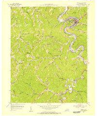
1954 Map of Pikeville
USGS Topo · Published 1956About this map
The Levisa Fork winds through the heart of this East Kentucky landscape, anchoring the bustling community of Pikeville. During the mid-1950s, this area served as a critical hub for the regional coal and transit economy, with the Chesapeake and Ohio railroad following the river's curves to connect settlements like Mayo Village, Kewanee, and Yeager. The map reveals a dense network of mountain hollows, each often supporting its own local institution, such as the Little Dixie Sch and Upper Hurricane Sch.
Find a feature on this map
79 named features on this map. Tap any name to fly to it.
Don’t see what you’re looking for? This feature index may not catch every label — zoom into the map to look around manually.
Map Details
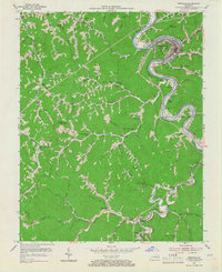
Editions of this 1954 Pikeville Map
2 editions found
Other maps of this area

1886 · Prestonsburg
USGS Topo · 1:125,000

1886 · Grundy
USGS Topo · 1:125,000

1887 · Warfield
USGS Topo · 1:125,000

1890 · Whitesburg
USGS Topo · 1:125,000

1890 · Grundy
USGS Topo · 1:125,000

1891 · Warfield
USGS Topo · 1:125,000

1892 · Grundy
USGS Topo · 1:125,000

1892 · Whitesburg
USGS Topo · 1:125,000

1892 · Prestonsburg
USGS Topo · 1:125,000

1914 · Laynesville
USGS Topo · 1:48,000