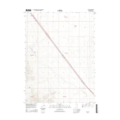
2014 Map of Pilot
USGS Topo · Published 2014About this map
The high desert terrain of Elko County is defined here by the towering presence of Pilot, the prominent peak that overlooks the expansive Pilot Creek Valley. This 2014 survey documents the transit corridor of Alt 93, which cuts a straight diagonal path across the Great Basin landscape, following the gradual descent from the mountain slopes toward the valley floor. To the south, the Playa Reservoir and the drainage of Pilot Cr represent the critical and scarce water resources in this arid environment. The map also delineates Morris Basin, a distinct topographical depression west of the main peak. This document serves as a detailed record of public land management and topography in the decade following the turn of the century, showing the intersection of historical township boundaries and modern transportation infrastructure.
Find a feature on this map
12 named features on this map. Tap any name to fly to it.
Don’t see what you’re looking for? This feature index may not catch every label — zoom into the map to look around manually.
Map Details
Editions of this 2014 Pilot Map
This is the sole edition of this map. No revisions or reprints were ever made.
Other maps of this area

1955 · Elko
USGS Topo · 1:250,000

1958 · Elko
USGS Topo · 1:250,000

1962 · Elko
USGS Topo · 1:250,000

1965 · Elko
USGS Topo · 1:250,000

1971 · West Morris Basin
USGS Topo · 1:24,000
1971 · Silver Zone Pass
USGS Topo · 1:24,000
1971 · Miners Canyon
USGS Topo · 1:24,000

1971 · Pilot
USGS Topo · 1:24,000

1971 · Leppy Peak
USGS Topo · 1:24,000
1971 · Leppy Peak NW
USGS Topo · 1:24,000