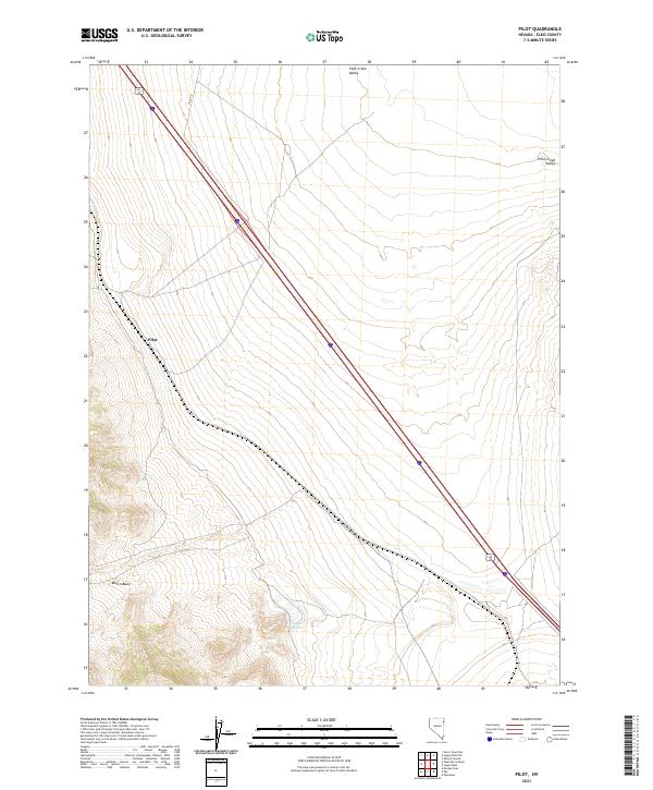
2021 Map of Pilot
USGS Topo · Published 2021About this map
Pilot Creek Valley dominates this high-desert landscape in Elko County, where the stark topography of northeastern Nevada is shaped by seasonal water and vast alluvial plains. The small settlement of Pilot sits at the base of the rising mountains to the west, serving as a localized waypoint along the straight trajectory of Alt 93. This corridor, paired with Pilot Rd, outlines the modern transportation network through a region traditionally defined by its cattle ranching and open range. To the south, the presence of Playa Reservoir and the sheltered lowlands of Morris Basin suggest a reliance on intermittent water sources in an otherwise arid environment. The map captures a quiet corner of the Great Basin, where the land is strictly partitioned by the Public Land Survey System, as indicated by the various township and range boundaries including t34n r68e.
Find a feature on this map
12 named features on this map. Tap any name to fly to it.
Don’t see what you’re looking for? This feature index may not catch every label — zoom into the map to look around manually.
Map Details
Editions of this 2021 Pilot Map
This is the sole edition of this map. No revisions or reprints were ever made.
Other maps of this area

1955 · Elko
USGS Topo · 1:250,000

1958 · Elko
USGS Topo · 1:250,000

1962 · Elko
USGS Topo · 1:250,000

1965 · Elko
USGS Topo · 1:250,000

1971 · West Morris Basin
USGS Topo · 1:24,000
1971 · Silver Zone Pass
USGS Topo · 1:24,000
1971 · Miners Canyon
USGS Topo · 1:24,000

1971 · Pilot
USGS Topo · 1:24,000

1971 · Leppy Peak
USGS Topo · 1:24,000
1971 · Leppy Peak NW
USGS Topo · 1:24,000