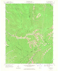
1968 Map of Pilot Knob
USGS Topo · Published 1971About this map
Kopperston and the surrounding coal-bearing ridges of the Kanawha Valley define this 1968 landscape, where industrial activity is deeply etched into the topography of the Appalachian Plateaus. The map reveals an extensive network of extractive operations, including Strip Mine sites, numerous Gas Well locations, and infrastructure like Mine Dump areas and a large Tailings Pond near the Norfolk and Western rail line. This industrial footprint is countered by small, localized landmarks like Ringwood Ch and family-named terrain features such as Jarrells Flats.
Find a feature on this map
50 named features on this map. Tap any name to fly to it.
Don’t see what you’re looking for? This feature index may not catch every label — zoom into the map to look around manually.
Map Details
Editions of this 1968 Pilot Knob Map
3 editions found
Other maps of this area

1891 · Oceana
USGS Topo · 1:125,000

1891 · Raleigh
USGS Topo · 1:125,000

1893 · Oceana
USGS Topo · 1:125,000

1897 · Raleigh
USGS Topo · 1:125,000

1898 · Oceana
USGS Topo · 1:125,000

1902 · Raleigh
USGS Topo · 1:125,000

1910 · Pineville
USGS Topo · 1:48,000

1910 · Bald Knob
USGS Topo · 1:48,000

1911 · Marshes
USGS Topo · 1:48,000

1912 · Mullens
USGS Topo · 1:62,500