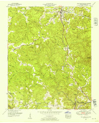
1952 Map of Pilot Mountain
USGS Topo · Published 1954About this map
The Cumberland Plateau and the Tennessee Valley converge here, creating a landscape defined by the drainage of Emery River and Clear Creek. The Southern railroad line is a central industrial feature, threading through the terrain via an Abandoned tunnel and serving settlements like Sunbright and Annadel. This 1952 revision provides a look at the rural social structure of Morgan County, where small family settlements and religious centers such as Garrett and Whiteoak Chapel are clustered near various family-named landmarks. The map is particularly dense with genealogical sites, showing numerous burial grounds like Summers Cemetery and Hendren Cemetery, alongside active community hubs like the Community Church and Springfield Chapel.
Find a feature on this map
51 named features on this map. Tap any name to fly to it.
Don’t see what you’re looking for? This feature index may not catch every label — zoom into the map to look around manually.
Map Details
Editions of this 1952 Pilot Mountain Map
3 editions found
Other maps of this area

1895 · Wartburg
USGS Topo · 1:125,000

1896 · Wartburg
USGS Topo · 1:125,000

1935 · Gobey
USGS Topo · 1:24,000

1935 · Camp Austin
USGS Topo · 1:24,000

1935 · Lancing
USGS Topo · 1:24,000

1935 · Pilot Mountain
USGS Topo · 1:24,000

1936 · Hebbertsburg
USGS Topo · 1:24,000

1936 · Twin Bridges
USGS Topo · 1:24,000
1943 · Hebbertsburg
USGS Topo · 1:24,000

1943 · Twin Bridges
USGS Topo · 1:24,000