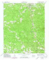
1952 Map of Pilot Mountain
USGS Topo · Published 1980About this map
Cumberland Plateau geography defines this portion of Morgan County, where the Tennessee Valley Divide snakes across the high ground between Sunbright and Pilot Mountain. The area’s 20th-century development is tied closely to the Southern railroad, which follows the natural corridor of the valley floor alongside Highway 27. Evidence of the region’s industrial and transit history is clear, from a strip mine near the northern border to an abandoned tunnel south of Annadel.
Find a feature on this map
57 named features on this map. Tap any name to fly to it.
Don’t see what you’re looking for? This feature index may not catch every label — zoom into the map to look around manually.
Map Details
Editions of this 1952 Pilot Mountain Map
3 editions found
Other maps of this area

1895 · Wartburg
USGS Topo · 1:125,000

1896 · Wartburg
USGS Topo · 1:125,000

1935 · Gobey
USGS Topo · 1:24,000

1935 · Camp Austin
USGS Topo · 1:24,000

1935 · Lancing
USGS Topo · 1:24,000

1935 · Pilot Mountain
USGS Topo · 1:24,000

1936 · Hebbertsburg
USGS Topo · 1:24,000

1936 · Twin Bridges
USGS Topo · 1:24,000
1943 · Hebbertsburg
USGS Topo · 1:24,000

1943 · Twin Bridges
USGS Topo · 1:24,000