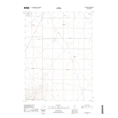
2018 Map of Pilot Peak NW
USGS Topo · Published 2018About this map
The eastern margins of the Toano Range give way to the broad expanses of Tecoma Valley and Pilot Creek Valley in this corner of Elko County. The landscape is defined by its arid drainage patterns, with Loray Wash and Pilot Cr cutting through the basin floor. Human activity is sparse and primarily infrastructure-based, centered around a grid of utilitarian thoroughfares such as Church Rd, Old Motel Rd, and Pilot Rd. These routes, along with curiously named tracks like Rocky Dirt RD and Burro Rd, suggest a history of ranching access or early twentieth-century roadside developments. In the northern reaches, a residential street grid including Cottonwood ST and Cactus DR indicates a small pocket of settlement positioned between the basin and the mountain foothills.
Find a feature on this map
22 named features on this map. Tap any name to fly to it.
Don’t see what you’re looking for? This feature index may not catch every label — zoom into the map to look around manually.
Map Details
Editions of this 2018 Pilot Peak NW Map
This is the sole edition of this map. No revisions or reprints were ever made.
Other maps of this area

1955 · Wells
USGS Topo · 1:250,000

1958 · Wells
USGS Topo · 1:250,000

1961 · Wells
USGS Topo · 1:250,000

1967 · Pilot Peak
USGS Topo · 1:24,000

1967 · Loray
USGS Topo · 1:24,000

1967 · Montello Canyon
USGS Topo · 1:24,000

1967 · Patterson Pass
USGS Topo · 1:24,000

1967 · Montello
USGS Topo · 1:24,000
1967 · Pilot Peak NW
USGS Topo · 1:24,000
1967 · Pilot Peak SW
USGS Topo · 1:24,000