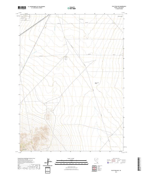
2021 Map of Pilot Peak NW
USGS Topo · Published 2021About this map
The Toana Range rises in the southwest corner of this high desert landscape, giving way to the broad expanse of Pilot Creek Valley and Tecoma Valley. This area of eastern Elko County is characterized by a sparse, functional road network that reflects the region's ranching and transit history. Significant drainage systems such as Loray Wash and Pilot Cr cut across the basin floors, marking the intermittent water sources critical to this arid environment. The presence of named routes like Old Motel Rd and Burro Rd suggests the historical pathways of early settlers and travelers through these wide valleys. In the northwest, a small grid of residential streets including Cottonwood St and Yucca Dr indicates a concentrated pocket of habitation within the otherwise open rangeland, situated along the north-south corridors connecting the desert basins.
Find a feature on this map
22 named features on this map. Tap any name to fly to it.
Don’t see what you’re looking for? This feature index may not catch every label — zoom into the map to look around manually.
Map Details
Editions of this 2021 Pilot Peak NW Map
This is the sole edition of this map. No revisions or reprints were ever made.
Other maps of this area

1955 · Wells
USGS Topo · 1:250,000

1958 · Wells
USGS Topo · 1:250,000

1961 · Wells
USGS Topo · 1:250,000

1967 · Pilot Peak
USGS Topo · 1:24,000

1967 · Loray
USGS Topo · 1:24,000

1967 · Montello Canyon
USGS Topo · 1:24,000

1967 · Patterson Pass
USGS Topo · 1:24,000

1967 · Montello
USGS Topo · 1:24,000
1967 · Pilot Peak NW
USGS Topo · 1:24,000
1967 · Pilot Peak SW
USGS Topo · 1:24,000