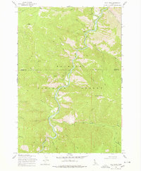
1969 Map of Pilot Peak
USGS Topo · Published 1978About this map
The South Fork Salmon River carves a deep path through the Payette National Forest in this late 1960s survey of the central Idaho interior. The landscape is defined by the logistics of mountain management and early resource extraction, centered around the South Fork Guard Station and the Pilot Peak Lookout at the higher elevations. Evidence of indigenous presence is noted with Petroglyphs found along the river's edge, while the industrial history is marked by a Mine near China Mountain and several Prospect locations scattered across the steep slopes. Transportation in this wilderness era relied heavily on a network of primitive routes, including the South Fork Trail and a Landing Strip for aerial access. Small outpost landmarks like Hays Station and Buck Saddle provide specific points of reference for those tracing the history of forest service operations and early mining in Valley County.
Find a feature on this map
32 named features on this map. Tap any name to fly to it.
Don’t see what you’re looking for? This feature index may not catch every label — zoom into the map to look around manually.
Map Details
Editions of this 1969 Pilot Peak Map
2 editions found

Other maps of this area

1937 · Big Creek
USGS Topo · 1:48,000

1942 · Big Creek
USGS Topo · 1:62,500

1956 · Warren
USGS Topo · 1:62,500

1956 · Elk City
USGS Topo · 1:250,000

1960 · Elk City
USGS Topo · 1:250,000

1969 · Profile Gap
USGS Topo · 1:24,000

1969 · Pony Meadows
USGS Topo · 1:24,000

1969 · Parks Peak
USGS Topo · 1:24,000

1969 · Wolf Fang Peak
USGS Topo · 1:24,000

1969 · Williams Peak
USGS Topo · 1:24,000