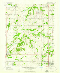
1958 Map of Pimento
USGS Topo · Published 1959About this map
The Terre Haute Federal Penitentiary dominates the northern landscape of this 1958 survey, complete with its own dedicated Prison Farm and Sewage Disposal system. This area of Vigo County exhibits a mix of structured institutional use and traditional rural settlement, where the Chicago and Eastern Illinois railroad serves as the primary industrial corridor, linking the communities of Pimento and Youngstown.
Find a feature on this map
31 named features on this map. Tap any name to fly to it.
Don’t see what you’re looking for? This feature index may not catch every label — zoom into the map to look around manually.
Map Details
Editions of this 1958 Pimento Map
3 editions found
Other maps of this area

1932 · Marshall
USGS Topo · 1:62,500

1937 · Marshall
USGS Topo · 1:62,500

1940 · Lewis
USGS Topo · 1:24,000

1940 · Pimento
USGS Topo · 1:24,000

1941 · Seelyville
USGS Topo · 1:24,000

1941 · Terre Haute
USGS Topo · 1:24,000

1942 · Fairbanks
USGS Topo · 1:24,000

1942 · Shelburn
USGS Topo · 1:24,000

1942 · Hutton
USGS Topo · 1:24,000

1942 · Dennison
USGS Topo · 1:24,000