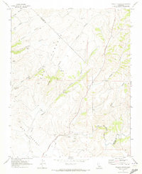
1969 Map of Pinalito Canyon
USGS Topo · Published 1973About this map
Pinalito sits within a complex network of drainages and valleys in the late 1960s, marking a rugged landscape where the boundary between San Benito County and Monterey County cuts diagonally through the hills. The terrain is defined by deep cuts such as Las Muertas Canyon and San Lorenzo Canyon, leading toward the drainage of San Lorenzo Creek. This period shows a landscape managed for resource extraction and ranching, evidenced by the numerous wells, water tanks, and quarries scattered throughout the territory.
Find a feature on this map
22 named features on this map. Tap any name to fly to it.
Don’t see what you’re looking for? This feature index may not catch every label — zoom into the map to look around manually.
Map Details
Editions of this 1969 Pinalito Canyon Map
2 editions found
Other maps of this area

1912 · Metz
USGS Topo · 1:31,680

1915 · Priest Valley
USGS Topo · 1:125,000

1919 · King City
USGS Topo · 1:62,500

1921 · Metz
USGS Topo · 1:62,500

1939 · King City
USGS Topo · 1:62,500

1940 · Metz
USGS Topo · 1:62,500

1941 · San Ardo
USGS Topo · 1:62,500

1943 · San Ardo
USGS Topo · 1:62,500

1943 · Hernandez Valley
USGS Topo · 1:62,500

1944 · Hernandez Valley
USGS Topo · 1:62,500