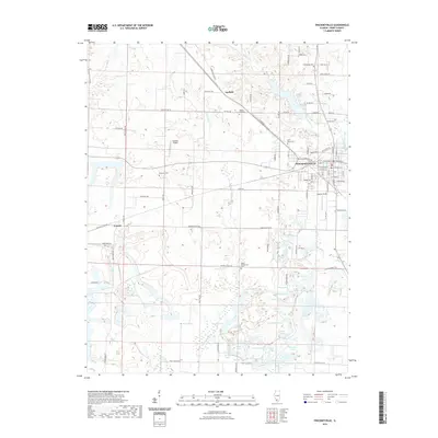
2021 Map of Pinckneyville
USGS Topo · Published 2021About this map
Pinckneyville serves as the focal point of this Perry County landscape, situated at the confluence of several local routes and the wandering Beaucoup Creek. The town's grid expands toward Panther Field, while the surrounding countryside is dotted with small agricultural settlements like Layfield and Conant. A notable cluster of water bodies to the south, including Plum Lake, Beehive Lake, and Crystal Lake, suggests a legacy of surface mining or land reclamation typical of southern Illinois. Genealogists will find a wealth of local history through numerous burial sites such as Saint Bruno Cem, Hopewell Cem, and Galum Presbyterian Cem. The presence of Lambert Airport and various rural roads named for flora—such as Petunia Rd and Zinnia Rd—reflects the modern organization of this historic farming and mining district.
Find a feature on this map
104 named features on this map. Tap any name to fly to it.
Don’t see what you’re looking for? This feature index may not catch every label — zoom into the map to look around manually.
Map Details
Editions of this 2021 Pinckneyville Map
This is the sole edition of this map. No revisions or reprints were ever made.
Other maps of this area

1910 · Murphysboro
USGS Topo · 1:62,500

1914 · Coulterville
USGS Topo · 1:62,500

1916 · Campbell Hill
USGS Topo · 1:62,500

1917 · Coulterville
USGS Topo · 1:62,500

1918 · Campbell Hill
USGS Topo · 1:62,500

1924 · Pinckneyville
USGS Topo · 1:62,500

1926 · Pinckneyville
USGS Topo · 1:62,500

1938 · Murphysboro
USGS Topo · 1:62,500

1949 · Paducah
USGS Topo · 1:250,000

1950 · Paducah
USGS Topo · 1:250,000