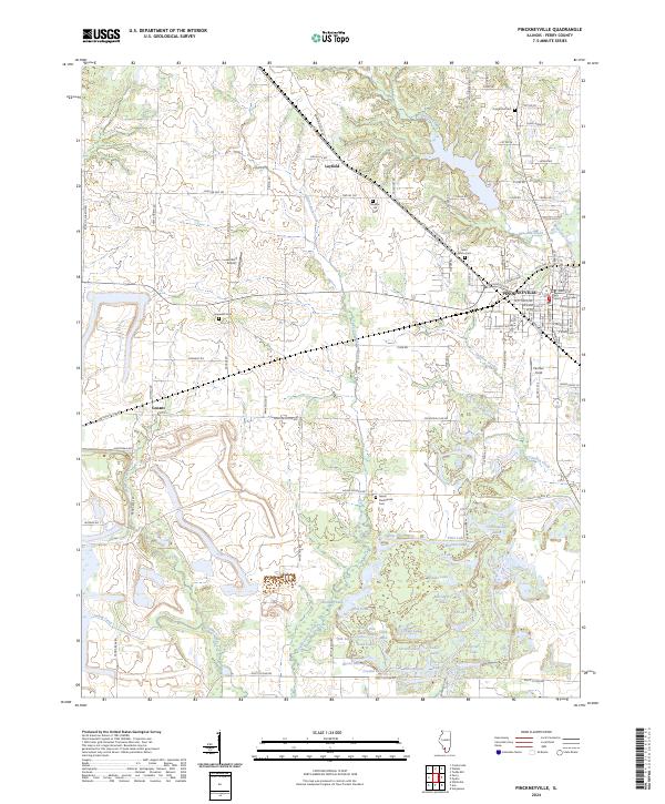
2024 Map of Pinckneyville
USGS Topo · Published 2024About this map
Pinckneyville serves as the focal point of this Southern Illinois landscape, anchored by the Perry County Courthouse. The map reveals a transition from the structured street grid of the city to the surrounding rural agricultural and water-heavy terrain. A dense concentration of small lakes and ponds, including Plum Lake, Hidden Lake, and the Chain Lakes, dominates the southern portion of the quadrangle along the Little Galum Creek and Galum Creek corridors. For family historians, the area is well-marked with legacy sites such as Oak Grove Cem, Mueller Hill Cem, and the Galum Presbyterian Cem. The presence of Lambert Airport and the crossroads at Layfield and Conant illustrate the transportation network that connects these scattered farming communities and water bodies.
Find a feature on this map
110 named features on this map. Tap any name to fly to it.
Don’t see what you’re looking for? This feature index may not catch every label — zoom into the map to look around manually.
Map Details
Editions of this 2024 Pinckneyville Map
This is the sole edition of this map. No revisions or reprints were ever made.
Other maps of this area

1910 · Murphysboro
USGS Topo · 1:62,500

1914 · Coulterville
USGS Topo · 1:62,500

1916 · Campbell Hill
USGS Topo · 1:62,500

1917 · Coulterville
USGS Topo · 1:62,500

1918 · Campbell Hill
USGS Topo · 1:62,500

1924 · Pinckneyville
USGS Topo · 1:62,500

1926 · Pinckneyville
USGS Topo · 1:62,500

1938 · Murphysboro
USGS Topo · 1:62,500

1949 · Paducah
USGS Topo · 1:250,000

1950 · Paducah
USGS Topo · 1:250,000