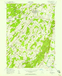
1956 Map of Pine Bush
USGS Topo · Published 1958About this map
Shawangunk Mountains rise in the northwest corner of this mid-century topographic survey, where the Verkeerder Kill and Shawangunk Kill cut through the rugged terrain of the Ulster and Orange County line. The valley below is defined by a traditional agricultural and transit landscape, centered on the village of Pine Bush and stretching south toward Montgomery. A clear rail corridor is established by the Erie RR, which serves several small rural hamlets including Bullville and Thompson Ridge.
Find a feature on this map
40 named features on this map. Tap any name to fly to it.
Don’t see what you’re looking for? This feature index may not catch every label — zoom into the map to look around manually.
Map Details
Editions of this 1956 Pine Bush Map
Other maps of this area

1902 · Schunemunk
USGS Topo · 1:62,500

1903 · Newburg
USGS Topo · 1:62,500

1904 · Ellenville
USGS Topo · 1:62,500

1906 · Ellenville
USGS Topo · 1:62,500

1906 · Goshen
USGS Topo · 1:62,500

1908 · Goshen
USGS Topo · 1:62,500

1930 · Schunemunk
USGS Topo · 1:48,000

1935 · Schunemunk
USGS Topo · 1:62,500

1938 · Goshen
USGS Topo · 1:62,500

1942 · Goshen
USGS Topo · 1:24,000