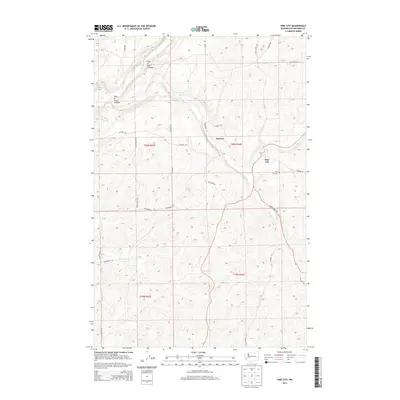
2014 Map of Pine City
USGS Topo · Published 2014About this map
Pine City and the nearby community of Kenova anchor this section of Whitman County, situated within a landscape defined by the winding course of Pine Cr. The terrain is notably interrupted by the deep depression of Hole-In-The-Ground and the waters of Bonnie Lake to the north. This 2014 survey documents the rural character of the region, where a network of family-named roads like Henry Hayes Rd, Leifer Rd, and Van Dyke Rd connect isolated farmsteads and agricultural plots.
Find a feature on this map
31 named features on this map. Tap any name to fly to it.
Don’t see what you’re looking for? This feature index may not catch every label — zoom into the map to look around manually.
Map Details
Editions of this 2014 Pine City Map
This is the sole edition of this map. No revisions or reprints were ever made.
Other maps of this area

1903 · Oakesdale
USGS Topo · 1:125,000

1905 · Oakesdale
USGS Topo · 1:125,000

1954 · Cheney
USGS Topo · 1:62,500

1954 · Spangle
USGS Topo · 1:62,500

1955 · Spokane
USGS Topo · 1:250,000

1958 · Spokane
USGS Topo · 1:250,000

1964 · St. John
USGS Topo · 1:24,000

1964 · Malden
USGS Topo · 1:24,000

1964 · Rock Lake
USGS Topo · 1:24,000
1964 · Thornton
USGS Topo · 1:24,000