
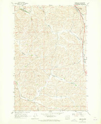
1964 Map of Pine City
USGS Topo · Published 1965About this map
Pine City and the neighboring siding of Kenova represent the agricultural and transit hubs of this Whitman County landscape in the mid-1960s. The region's economy is visibly tied to the Chicago Milwaukee St Paul and Pacific railroad, which follows the winding course of Pine Creek through a series of dramatic coulees and scabland formations. Evidence of the grain trade is prominent, with Grain Elevators located in the heart of town and Storage Bins positioned near the geological feature known as Rock Hole.
Find a feature on this map
19 named features on this map. Tap any name to fly to it.
Don’t see what you’re looking for? This feature index may not catch every label — zoom into the map to look around manually.
Map Details
Editions of this 1964 Pine City Map
This is the sole edition of this map. No revisions or reprints were ever made.
Other maps of this area

1903 · Oakesdale
USGS Topo · 1:125,000

1905 · Oakesdale
USGS Topo · 1:125,000

1954 · Cheney
USGS Topo · 1:62,500

1954 · Spangle
USGS Topo · 1:62,500

1955 · Spokane
USGS Topo · 1:250,000

1958 · Spokane
USGS Topo · 1:250,000

1964 · St. John
USGS Topo · 1:24,000

1964 · Malden
USGS Topo · 1:24,000

1964 · Rock Lake
USGS Topo · 1:24,000
1964 · Thornton
USGS Topo · 1:24,000