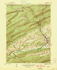
1946 Map of Pine Grove
USGS Topo · Published 1946About this map
Pine Grove serves as the primary hub of this 1946 Schuylkill County landscape, where the Reading railroad system weaves through a succession of prominent ridges including Broad Mountain, Sharp Mountain, and Second Mountain. The map reveals a post-war rural infrastructure defined by localized community centers such as Suedberg, Joliett, and Irving, each connected by a network of small schools like Outwood Sch and Exmoor Sch.
Find a feature on this map
52 named features on this map. Tap any name to fly to it.
Don’t see what you’re looking for? This feature index may not catch every label — zoom into the map to look around manually.
Map Details
Editions of this 1946 Pine Grove Map
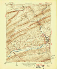
2 editions found
Other maps of this area

1891 · Lebanon
USGS Topo · 1:62,500

1892 · Lykens
USGS Topo · 1:62,500

1892 · Hummelstown
USGS Topo · 1:62,500

1892 · Pine Grove
USGS Topo · 1:62,500

1893 · Lykens
USGS Topo · 1:62,500

1893 · Lebanon
USGS Topo · 1:62,500

1899 · Lebanon
USGS Topo · 1:62,500

1924 · Hummelstown
USGS Topo · 1:62,500

1943 · Lebanon
USGS Topo · 1:62,500

1943 · Lykens
USGS Topo · 1:62,500
Featured Places
- Bethel Township, PA
- Hegins Township, PA
- Pine Grove, Pine Grove Township
- Union Township, PA
- Tremont Township, PA