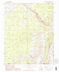
1987 Map of Pine Hollow Canyon
USGS Topo · Published 1987About this map
Paria Canyon-Vermilion Cliffs Wilderness defines the southeastern portion of this map, straddling the state line between Utah and Arizona. The dramatic geological uplift of The Cockscomb runs north-to-south, creating a sharp natural barrier and directing the drainage of ephemeral watercourses like Buckskin Gulch and Coyote Wash. Human infrastructure is sparse in this high-desert environment, evidenced by the presence of a few 4 WD tracks, a prominent Trans Line, and an Aqueduct crossing Telegraph Wash near Five Mile Mountain. Water management for livestock or local use is reflected in features such as Adams Reservoir and Bull Pasture Reservoirs, while a lone Radio Tower stands as a landmark on the northern heights. The map details the intricate drainage networks of Pine Hollow Canyon and Horse Canyon, illustrating the complex erosion patterns typical of the Paria plateau before the arrival of significant modern development.
Find a feature on this map
21 named features on this map. Tap any name to fly to it.
Don’t see what you’re looking for? This feature index may not catch every label — zoom into the map to look around manually.
Map Details
Editions of this 1987 Pine Hollow Canyon Map
2 editions found
Other maps of this area

1886 · Kanab
USGS Topo · 1:250,000

1886 · Escalante
USGS Topo · 1:250,000

1886 · Echo Cliffs
USGS Topo · 1:250,000

1886 · Kaibab
USGS Topo · 1:250,000

1891 · Echo Cliffs
USGS Topo · 1:250,000

1953 · Cedar City
USGS Topo · 1:250,000

1953 · Grand Canyon
USGS Topo · 1:250,000

1954 · Buckskin Gulch NW
USGS Topo · 1:24,000

1954 · Buckskin Gulch NE
USGS Topo · 1:24,000

1954 · Buckskin Gulch SE
USGS Topo · 1:24,000