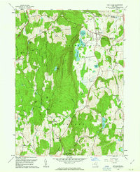
1960 Map of Pine Plains
USGS Topo · Published 1963About this map
Stissing Mountain dominates this portion of Northern Dutchess County, casting a long shadow over the low-lying wetlands and glacial lakes to its east. In the valley below, the village of Pine Plains serves as a central hub for the surrounding agricultural community, situated near the headwaters of Wappinger Creek. The landscape is defined by its complex hydrology, where Twin Island Lake, Stissing Pond, and Thompson Pond form a chain of water bodies just south of the village.
Find a feature on this map
53 named features on this map. Tap any name to fly to it.
Don’t see what you’re looking for? This feature index may not catch every label — zoom into the map to look around manually.
Map Details
Editions of this 1960 Pine Plains Map
4 editions found
Other maps of this area

1895 · Catskill
USGS Topo · 1:62,500

1898 · Rhinebeck
USGS Topo · 1:62,500

1899 · Millbrook
USGS Topo · 1:62,500

1902 · Millbrook
USGS Topo · 1:62,500

1902 · Copake
USGS Topo · 1:62,500

1904 · Copake
USGS Topo · 1:62,500

1934 · Rhinebeck
USGS Topo · 1:48,000

1934 · Catskill
USGS Topo · 1:62,500

1938 · Catskill
USGS Topo · 1:62,500

1939 · Rhinebeck
USGS Topo · 1:62,500