
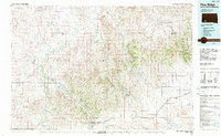
1985 Map of Pine Ridge
USGS Topo · Published 1985About this map
The Pine Ridge Indian Reservation spans this 1985 planimetric survey, documenting the intricate network of creek drainages and community hubs across the Oglala Lakota landscape. The map centers on the major drainages of Wounded Knee Creek and Porcupine Creek as they flow north toward the White River. Named communities such as Manderson, Porcupine, and Oglala are situated along these waterways, reflecting a settlement pattern deeply tied to the natural geography of the region.
Find a feature on this map
73 named features on this map. Tap any name to fly to it.
Don’t see what you’re looking for? This feature index may not catch every label — zoom into the map to look around manually.
Map Details
Editions of this 1985 Pine Ridge Map
2 editions found
Other maps of this area

1894 · Hermosa
USGS Topo · 1:125,000

1896 · Oelrichs
USGS Topo · 1:125,000

1900 · Oelrichs
USGS Topo · 1:125,000

1901 · Hermosa
USGS Topo · 1:125,000

1950 · Stirk Table
USGS Topo · 1:24,000

1950 · Cuny Table East
USGS Topo · 1:24,000

1950 · Conata SW
USGS Topo · 1:24,000

1950 · Potato Creek
USGS Topo · 1:24,000

1950 · Imlay SW
USGS Topo · 1:24,000

1950 · Imlay SE
USGS Topo · 1:24,000