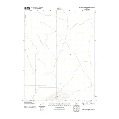
2010 Map of Pine Valley Hardpan North
USGS Topo · Published 2010About this map
Pine Valley Hardpan dominates the southern landscape of this Millard County quadrant, illustrating a distinctive geological feature within the arid Great Basin. The terrain is defined by the sharp verticality of the Tunnel Spring Mountains to the northwest, which transition into the broad, flat expanse of Pine Valley. This area is characterized by its isolation and the systematic grid of rural access routes, including S 25000 St W, W 14900 S, and W 15800 S. These roads provide the primary structural framework for navigating the valley floor, connecting the few identifiable landmarks across the expansive desert terrain. The juxtaposition of the mountain range and the dry lakebed suggests a landscape defined more by natural boundaries and resource access than by dense settlement.
Find a feature on this map
6 named features on this map. Tap any name to fly to it.
Don’t see what you’re looking for? This feature index may not catch every label — zoom into the map to look around manually.
Map Details
Editions of this 2010 Pine Valley Hardpan North Map
This is the sole edition of this map. No revisions or reprints were ever made.
Other maps of this area

1953 · Richfield
USGS Topo · 1:250,000

1958 · Richfield
USGS Topo · 1:250,000

1960 · Burbank Hills
USGS Topo · 1:62,500

1960 · Wah Wah Summit
USGS Topo · 1:62,500

1960 · Crystal Peak
USGS Topo · 1:62,500

1971 · Halfway Summit
USGS Topo · 1:24,000

1971 · Tunnel Spring
USGS Topo · 1:24,000

1980 · Wah Wah Mts. North
USGS Topo · 1:100,000
1989 · Wah Wah Summit
USGS Topo · 1:24,000
1989 · Pine Valley Hardpan South
USGS Topo · 1:24,000