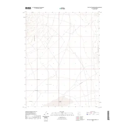
2023 Map of Pine Valley Hardpan North
USGS Topo · Published 2023About this map
Pine Valley's expansive desert floor dominates this Millard County landscape, bracketed by the striking topography of the Tunnel Spring Mountains to the west and the Wah Wah Mountains to the east. This modern topographic study reveals a corner of the Great Basin defined by its seasonal hydrography, most notably the Pine Valley Hardpan, a dry lake bed that serves as the terminal point for local drainage. The map documents a sparse network of access roads, including W 14900 South St and the specialized Pine Valley Well Rd, reflecting the area's use for range management and hydrological monitoring. These features suggest an environment where water—or the historical absence of it—has dictated both the terrain's character and the limited human infrastructure etched into the valley.
Find a feature on this map
8 named features on this map. Tap any name to fly to it.
Don’t see what you’re looking for? This feature index may not catch every label — zoom into the map to look around manually.
Map Details
Editions of this 2023 Pine Valley Hardpan North Map
This is the sole edition of this map. No revisions or reprints were ever made.
Other maps of this area

1953 · Richfield
USGS Topo · 1:250,000

1958 · Richfield
USGS Topo · 1:250,000

1960 · Burbank Hills
USGS Topo · 1:62,500

1960 · Wah Wah Summit
USGS Topo · 1:62,500

1960 · Crystal Peak
USGS Topo · 1:62,500

1971 · Halfway Summit
USGS Topo · 1:24,000

1971 · Tunnel Spring
USGS Topo · 1:24,000

1980 · Wah Wah Mts. North
USGS Topo · 1:100,000
1989 · Wah Wah Summit
USGS Topo · 1:24,000
1989 · Pine Valley Hardpan South
USGS Topo · 1:24,000