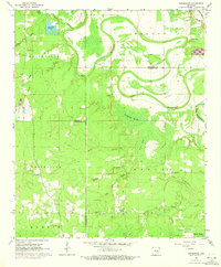
1964 Map of Pinebergen
USGS Topo · Published 1973About this map
Bayou Bartholomew snakes through the landscape, defining the boundary between Jefferson and Lincoln counties during this 1960s survey. The map reveals a rural Arkansas community centered around crossroads and small gathering places like Hooker and Griffith Springs. Notable for genealogists, the terrain is dotted with local landmarks such as Shell Chapel and Wheeler Chapel, alongside family-named burial grounds including Jefferson Cem and Grahams Cem.
Find a feature on this map
37 named features on this map. Tap any name to fly to it.
Don’t see what you’re looking for? This feature index may not catch every label — zoom into the map to look around manually.
Map Details
Editions of this 1964 Pinebergen Map
3 editions found
Other maps of this area

1935 · Feenyville
USGS Topo · 1:62,500

1935 · Noble Lake
USGS Topo · 1:62,500

1948 · Helena
USGS Topo · 1:250,000

1950 · Helena
USGS Topo · 1:250,000

1953 · Greenwood
USGS Topo · 1:250,000

1953 · El Dorado
USGS Topo · 1:250,000

1955 · Helena
USGS Topo · 1:250,000

1955 · Little Rock
USGS Topo · 1:250,000

1956 · Little Rock
USGS Topo · 1:250,000

1956 · Greenwood
USGS Topo · 1:250,000