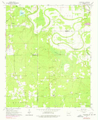
1964 Map of Pinebergen
USGS Topo · Published 1977About this map
Bayou Bartholomew snakes through this landscape, defining the boundaries between Jefferson, Lincoln, and Cleveland Counties. The area's agricultural and rural character is anchored by small settlements like Pinebergen and Griffith Springs, which are connected by a network of local roads and water crossings. The map reveals a high density of rural community centers, particularly churches such as Canaan Ch, Shell Chapel, and Macedonia Ch, often situated alongside local schools like Mt Olive Sch.
Find a feature on this map
39 named features on this map. Tap any name to fly to it.
Don’t see what you’re looking for? This feature index may not catch every label — zoom into the map to look around manually.
Map Details
Editions of this 1964 Pinebergen Map
3 editions found
Other maps of this area

1935 · Feenyville
USGS Topo · 1:62,500

1935 · Noble Lake
USGS Topo · 1:62,500

1948 · Helena
USGS Topo · 1:250,000

1950 · Helena
USGS Topo · 1:250,000

1953 · Greenwood
USGS Topo · 1:250,000

1953 · El Dorado
USGS Topo · 1:250,000

1955 · Helena
USGS Topo · 1:250,000

1955 · Little Rock
USGS Topo · 1:250,000

1956 · Little Rock
USGS Topo · 1:250,000

1956 · Greenwood
USGS Topo · 1:250,000