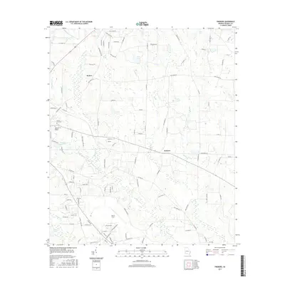
2017 Map of Pineboro
USGS Topo · Published 2017About this map
The agricultural and aviation landscape of Colquitt County unfolds across this 2017 survey, centered on the communities of Barbers and Pineboro. At the heart of the region, the expansive Spence Airport serves as a major landmark, reflecting the area's development of regional infrastructure alongside traditional rural life. The terrain is defined by a complex network of waterways, including the winding Indian Cr and Okapilco Cr, which feed into local basins like Colquitt County Lake and Cobb Lake. Local history is anchored by sites of remembrance and community, such as Pleasant Grove Cem and Baker Hillcrest Memorial Gardens. The settlement pattern shows a mix of established rural crossroads and newer residential developments such as Norman Ests and Hidden Acres, illustrating the gradual shift in land use in this Georgia coastal plain region.
Find a feature on this map
107 named features on this map. Tap any name to fly to it.
Don’t see what you’re looking for? This feature index may not catch every label — zoom into the map to look around manually.
Map Details
Editions of this 2017 Pineboro Map
This is the sole edition of this map. No revisions or reprints were ever made.
Other maps of this area

1953 · Waycross
USGS Topo · 1:250,000

1956 · Doerun
USGS Topo · 1:62,500

1958 · Waycross
USGS Topo · 1:250,000

1973 · Norman Park
USGS Topo · 1:24,000

1973 · Omega
USGS Topo · 1:24,000

1974 · Berlin East
USGS Topo · 1:24,000
1974 · Sigsbee
USGS Topo · 1:24,000

1974 · Pineboro
USGS Topo · 1:24,000
1974 · Ellenton
USGS Topo · 1:24,000
1978 · Coolidge
USGS Topo · 1:24,000