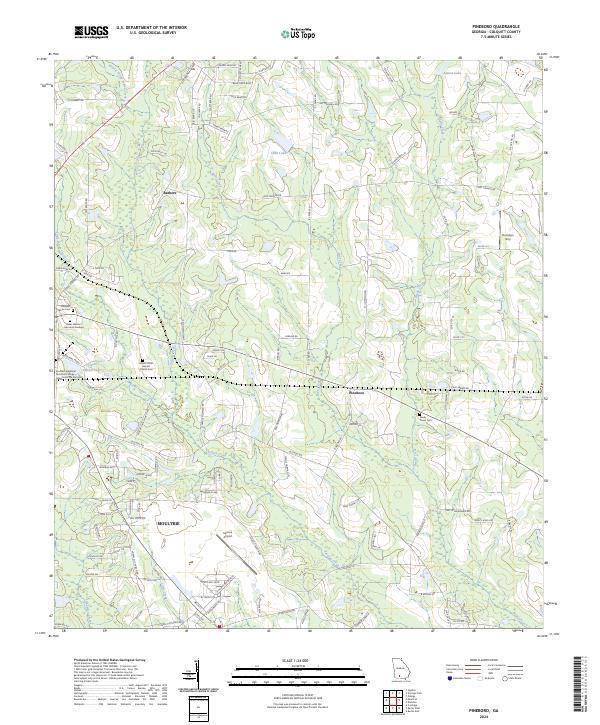
2024 Map of Pineboro
USGS Topo · Published 2024About this map
Moultrie sits at the southern edge of this map, serving as the primary hub for a landscape defined by agricultural operations and technical industry. The northern reaches of the city are marked by the Southern Regional Technical College - Industrial Drive Campus and the expansive Spence Airport, formerly a military training base. The surrounding Colquitt County countryside is dotted with small rural communities like Pineboro and Barbers, as well as numerous family and church burial grounds including Mount Olive Baptist Church Cem and Reedy Creek Cem.
Find a feature on this map
122 named features on this map. Tap any name to fly to it.
Don’t see what you’re looking for? This feature index may not catch every label — zoom into the map to look around manually.
Map Details
Editions of this 2024 Pineboro Map
This is the sole edition of this map. No revisions or reprints were ever made.
Other maps of this area

1953 · Waycross
USGS Topo · 1:250,000

1956 · Doerun
USGS Topo · 1:62,500

1958 · Waycross
USGS Topo · 1:250,000

1973 · Norman Park
USGS Topo · 1:24,000

1973 · Omega
USGS Topo · 1:24,000

1974 · Berlin East
USGS Topo · 1:24,000
1974 · Sigsbee
USGS Topo · 1:24,000

1974 · Pineboro
USGS Topo · 1:24,000
1974 · Ellenton
USGS Topo · 1:24,000
1978 · Coolidge
USGS Topo · 1:24,000