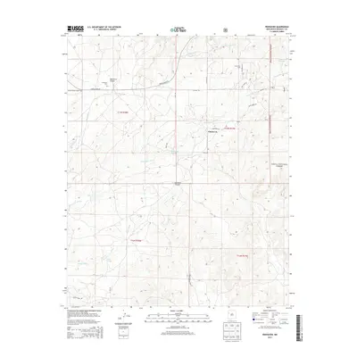
2013 Map of Pinehaven
USGS Topo · Published 2013About this map
Manuelito Canyon and Coal Mine Canyon define the landscape of this high-desert region south of Gallup, where water management is etched into the terrain through features like the Navajo Stock Tank and Pinos Lake. The settlement patterns here in the early 21st century center on the community of Pinehaven and the nearby Pine Haven Acres, served by a network of rural routes such as Bread Spring Rd and Indian Service Route 29. Genealogical interest is anchored at the Pinehaven Cem, located just south of the canyon's edge. The eastern portion of the map is dominated by the boundaries of the Cibola National Forest, while the drainage system of Whitewater Arroyo and Skeets Wash illustrates the hydrological connectivity of this corner of New Mexico.
Find a feature on this map
30 named features on this map. Tap any name to fly to it.
Don’t see what you’re looking for? This feature index may not catch every label — zoom into the map to look around manually.
Map Details
Editions of this 2013 Pinehaven Map
This is the sole edition of this map. No revisions or reprints were ever made.
Other maps of this area

1886 · Wingate
USGS Topo · 1:250,000

1892 · Wingate
USGS Topo · 1:250,000

1954 · Gallup
USGS Topo · 1:250,000

1958 · Gallup
USGS Topo · 1:250,000

1959 · Gallup
USGS Topo · 1:250,000

1962 · Gallup
USGS Topo · 1:250,000

1963 · Twin Buttes
USGS Topo · 1:24,000

1963 · Pinehaven
USGS Topo · 1:24,000
1963 · Upper Nutria
USGS Topo · 1:24,000
1963 · Bread Springs
USGS Topo · 1:24,000