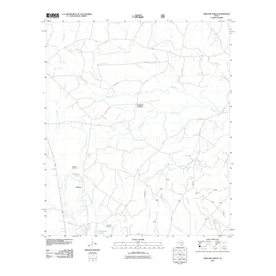
2010 Map of Pineland North
USGS Topo · Published 2010About this map
Magasco and the rural roads of Sabine County define this East Texas landscape as it appeared in the early 21st century. The terrain is a network of bayous and creeks, with Housen Bayou winding through the center and carving out the landmark Housen Holw. This survey documents a region where local water resources were heavily managed for industry or recreation, evidenced by Magasco Lake and its corresponding Magasco Lake Dam, along with Temple-Eastex Lake B-2.
Find a feature on this map
58 named features on this map. Tap any name to fly to it.
Don’t see what you’re looking for? This feature index may not catch every label — zoom into the map to look around manually.
Map Details
Editions of this 2010 Pineland North Map
This is the sole edition of this map. No revisions or reprints were ever made.
Other maps of this area

1953 · Alexandria
USGS Topo · 1:250,000

1953 · Palestine
USGS Topo · 1:250,000

1955 · Alexandria
USGS Topo · 1:250,000

1957 · Palestine
USGS Topo · 1:250,000

1957 · Brookeland
USGS Topo · 1:62,500

1958 · Hemphill
USGS Topo · 1:62,500

1958 · Mc Gee Bend
USGS Topo · 1:62,500

1958 · Bronson
USGS Topo · 1:62,500

1969 · Brookeland
USGS Topo · 1:62,500
1984 · Milam
USGS Topo · 1:24,000