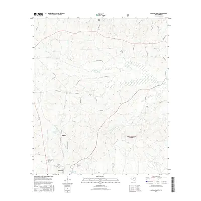
2016 Map of Pineland North
USGS Topo · Published 2016About this map
Sabine National Forest dominates the eastern half of this landscape, where the headwaters of numerous creeks like Pace Cr and Fish Cr weave through the timberlands of Sabine County. The settlement of Pineland serves as a southern anchor, flanked by industrial water features like Temple-Eastex Lake B-2. To the north, the community of Magasco is situated near Magasco Lake, reflecting a rural Texas pattern of small pockets of habitation centered around water and forest resources.
Find a feature on this map
70 named features on this map. Tap any name to fly to it.
Don’t see what you’re looking for? This feature index may not catch every label — zoom into the map to look around manually.
Map Details
Editions of this 2016 Pineland North Map
This is the sole edition of this map. No revisions or reprints were ever made.
Other maps of this area

1953 · Alexandria
USGS Topo · 1:250,000

1953 · Palestine
USGS Topo · 1:250,000

1955 · Alexandria
USGS Topo · 1:250,000

1957 · Palestine
USGS Topo · 1:250,000

1957 · Brookeland
USGS Topo · 1:62,500

1958 · Hemphill
USGS Topo · 1:62,500

1958 · Mc Gee Bend
USGS Topo · 1:62,500

1958 · Bronson
USGS Topo · 1:62,500

1969 · Brookeland
USGS Topo · 1:62,500
1984 · Milam
USGS Topo · 1:24,000