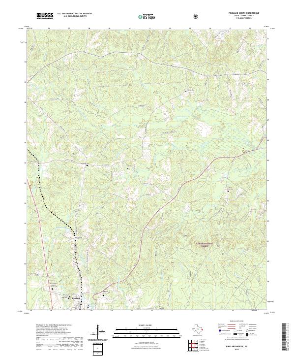
2022 Map of Pineland North
USGS Topo · Published 2022About this map
Pineland and the smaller community of Magasco serve as the primary human settlements in this pocket of East Texas, where the landscape is defined by the dense timber of the Sabine National Forest. The area is intricately drained by a network of waterways including Housen Bayou, Pace Creek, and Beech Creek, flowing through varied terrain like Housen Hollow and along Rosin Ridge. For local historians and genealogists, the map reveals a high density of small family or community burial grounds, such as Pine Hill Cemetery, Lott Cemetery, and Jacks Cemetery. Transportation in the region relies on a mix of state routes and forestry roads like Forest Road 133, illustrating the area's continued reliance on the lumber industry and its rural character. The presence of Bethel Chapel Baptist Church and Pleasant Grove Cemetery provides further evidence of the deep-rooted community foundations throughout the Piney Woods.
Find a feature on this map
74 named features on this map. Tap any name to fly to it.
Don’t see what you’re looking for? This feature index may not catch every label — zoom into the map to look around manually.
Map Details
Editions of this 2022 Pineland North Map
This is the sole edition of this map. No revisions or reprints were ever made.
Other maps of this area

1953 · Alexandria
USGS Topo · 1:250,000

1953 · Palestine
USGS Topo · 1:250,000

1955 · Alexandria
USGS Topo · 1:250,000

1957 · Palestine
USGS Topo · 1:250,000

1957 · Brookeland
USGS Topo · 1:62,500

1958 · Hemphill
USGS Topo · 1:62,500

1958 · Mc Gee Bend
USGS Topo · 1:62,500

1958 · Bronson
USGS Topo · 1:62,500

1969 · Brookeland
USGS Topo · 1:62,500
1984 · Milam
USGS Topo · 1:24,000