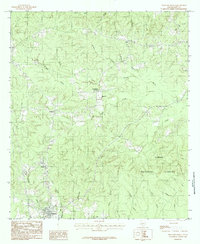
1984 Map of Pineland North
USGS Topo · Published 1984About this map
The Sabine National Forest dominates this East Texas landscape, where a dense network of creeks and bayous defines the terrain. The settlement of Pineland serves as a local hub at the southern edge, while smaller communities like Magasco, Plainview, and Pine Park are connected by forest roads and a prominent Pipeline. This era of the late 1970s and early 1980s shows the region's heavy reliance on timber and natural resource management, with topography marked by features like Rosin Ridge and the winding Housen Bayou.
Find a feature on this map
31 named features on this map. Tap any name to fly to it.
Don’t see what you’re looking for? This feature index may not catch every label — zoom into the map to look around manually.
Map Details
Editions of this 1984 Pineland North Map
This is the sole edition of this map. No revisions or reprints were ever made.
Other maps of this area

1953 · Alexandria
USGS Topo · 1:250,000

1953 · Palestine
USGS Topo · 1:250,000

1955 · Alexandria
USGS Topo · 1:250,000

1957 · Palestine
USGS Topo · 1:250,000

1957 · Brookeland
USGS Topo · 1:62,500

1958 · Hemphill
USGS Topo · 1:62,500

1958 · Mc Gee Bend
USGS Topo · 1:62,500

1958 · Bronson
USGS Topo · 1:62,500

1969 · Brookeland
USGS Topo · 1:62,500
1984 · Milam
USGS Topo · 1:24,000