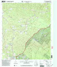
2003 Map of Pineland North
USGS Topo · Published 2004About this map
Pineland and the northern reaches of the Sabine National Forest define this East Texas landscape as it appeared in the early 21st century. The map reveals a rural geography heavily shaped by timber interests and the drainages of Housen Bayou and Mc Kain Branch. While topographic data was compiled in the 1970s, this 2003 revision documents the modern transportation network, including Strickland Crossing East Road and Tatom Road, which connect small communities and family-named landmarks.
Find a feature on this map
32 named features on this map. Tap any name to fly to it.
Don’t see what you’re looking for? This feature index may not catch every label — zoom into the map to look around manually.
Map Details
Editions of this 2003 Pineland North Map
This is the sole edition of this map. No revisions or reprints were ever made.
Other maps of this area

1953 · Alexandria
USGS Topo · 1:250,000

1953 · Palestine
USGS Topo · 1:250,000

1955 · Alexandria
USGS Topo · 1:250,000

1957 · Palestine
USGS Topo · 1:250,000

1957 · Brookeland
USGS Topo · 1:62,500

1958 · Hemphill
USGS Topo · 1:62,500

1958 · Mc Gee Bend
USGS Topo · 1:62,500

1958 · Bronson
USGS Topo · 1:62,500

1969 · Brookeland
USGS Topo · 1:62,500
1984 · Milam
USGS Topo · 1:24,000